
Photo credit: Hellenic Ministry of Foreign Affairs
Turkey has ignited fresh tensions with Greece by unveiling a marine spatial planning map which has drawn sharp criticism from Athens for its lack of legal basis and attempt to usurp areas of Greek jurisdiction.
The Turkish MSP map has been published on the MSPGlobal platform and made accessible to the international community after its submission to IOC-UNESCO for official registration.
Ankara described the release of its map as a “landmark development” in the history of Turkish maritime governance.
Greek officials argue that the map lacks legal standing and constitutes a reflexive reaction “devoid of content.”
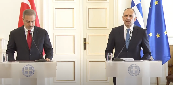
Just hours after Turkey’s publication, Greece’s foreign ministry issued a sharp rebuttal. It was emphasized that while the Turkish map was a response to a Greek plan already part of the European acquis, the crucial difference lies in its legality.
The Greek ministry stated that the Turkish map “has no basis in international law, as it attempts to usurp areas of Greek jurisdiction, and is not addressed to an international organization that imposes an obligation to post such relevant maps.”
It called on Turkey to end its claims and warned that it would take, “appropriate action in all international fora.” “Greece will insist on the policy of principles it applies and calls on Turkey not to make maximalist claims that everyone understands are for internal use only,” it added.
Earlier this year, Greece announced a long-awaited maritime spatial planning (MSP), irking neighboring Turkey which described it as a unilateral action violating Türkiye’s maritime jurisdiction areas in both the Aegean Sea and the Eastern Mediterranean.
The Greek foreign minister Giorgos Gerapetritis, speaking on media channel Skai, called the immediate reaction from Ankara “expected.”
Ankara’s submission to UNESCO follows Greece’s adoption of a comprehensive Maritime Spatial Planning (MSP) with the issuance of the National Spatial Strategy for the Marine Space (NSSMS) in April 2025, which was described by the Greek environment and energy ministry as a “significant strategic milestone in the country’s spatial planning,” as for the first time, the Greek state defines detailed uses of its maritime zones, implementing the obligation deriving from directive 2014/89/EU and exercising the rights stemming from the international law.
Turkey has also signalled its intent to submit its MSP to the relevant bodies of the United Nations, a move that could escalate the dispute further.
As both nations navigate this latest flare-up, Greek officials express the opinion that the Turkish map reflects Ankara’s well-known stance, and it is an “expected reaction.”
“The map, which was published in the previous days by Turkey, is a map that has been circulating for fifteen years. Therefore, we expected this reaction from Turkey, which was anyway announced in advance,” Giorgos Gerapetritis responded to a relevant question by a Greek reporter on Wednesday to the television network in Greece, Mega.