Latest contract win by Holland-based Geo-data specialist Fugro will map Norway´s seabed to generate scientific information for the responsible management and preservation of Norway’s marine resources.
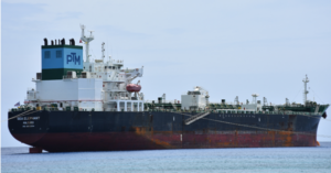
Fugro’s survey vessel will obtain comprehensive marine Geo-data for the Norwegian mapping programme.
Geo-data specialist Fugro won a new hydrographic survey contract for the 2023 Mareano seabed mapping programme, which is supported by the Central Government of Norway.
Fugro has been actively involved in the programme since 2006 and has acquired over 142,000 km2 of data.
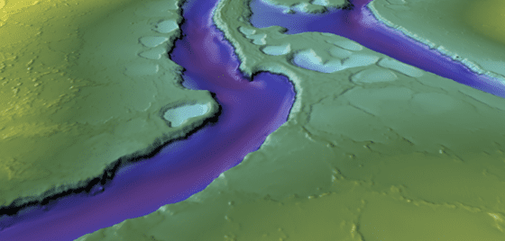
The 2023 survey will cover a region in the North Sea, spanning 2,887km2, where water depths range between 140 and 335 metres.
The primary goal of the survey is to gather high-quality, seamless datasets that integrate bathymetry and acoustic backscatter data to improve our understanding of the marine environment in the North Sea.
This knowledge is essential for the sustainable development of new marine industries, such as offshore wind and offshore aquaculture, and for the protection of particularly valuable and vulnerable areas (SVOs) in the region.
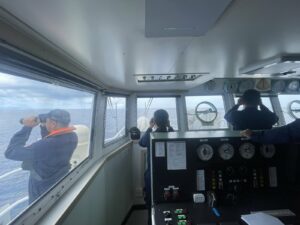
Fugro’s survey vessel, equipped with advanced high-resolution, high-density multibeam echo sounders and sub-bottom data acquisition systems, will obtain comprehensive marine Geo-data for the Norwegian mapping programme. Fieldwork is scheduled to take place between July and late August this year.
Transit data for Seabed 2030 will be collected by Fugro, adding to the more than 2 million km2 of bathymetry data already collected for the project. This data will help to create a more complete and accurate map of the world’s ocean floor, which is essential for understanding and managing ocean resources, protecting marine ecosystems, and mitigating the effects of climate change.