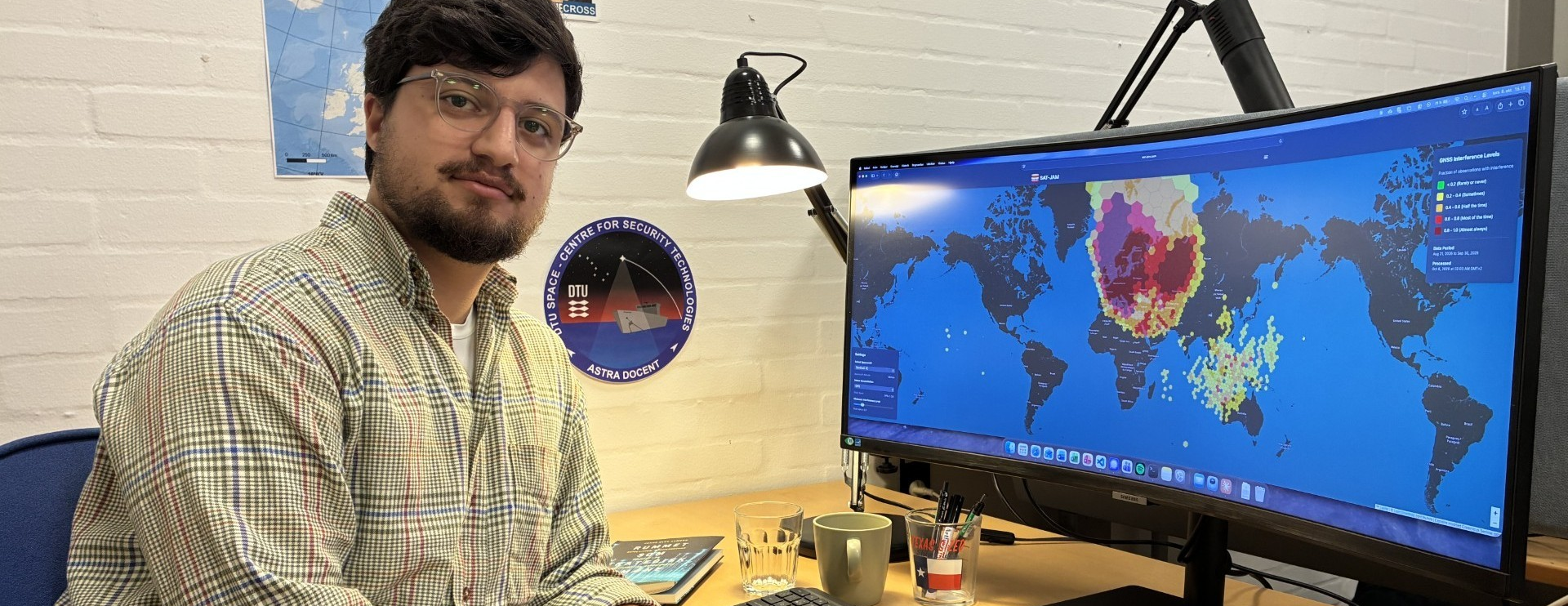

A free online map, SAT-JAM, showing where satellites experience GNSS interference, including possible jamming, has been created by researchers from DTU Space at the Technical University of Denmark.
The GPS jamming that has disrupted flights and shipping across Europe due to conflict in recent years does not stop at the clouds. It also reaches Earth observation and communication satellites in space hundreds of kilometres above Earth, shows new research from DTU Space.
The researchers have analysed and mapped areas over Europe where jamming disrupts some satellites’ ability to determine their own position.
Based on analysis and publicly available data, they have written a scientific paper and created the free online map.
“With this online tool, anyone interested can now see where jamming is affecting satellites in space,” said Kian Bostani Nezhad, scientist and PhD student at DTU Space and Centre for Security DTU, who led the development of the SAT-JAM map.
He is also the lead author of the scientific paper on the subject recently presented at the Advanced Maui Optical and Space Surveillance Technologies Conference 2026 (AMOS).
“Most people see GPS jamming as a problem for airplanes and ships. Few would imagine that it can also reach and disrupt a lot of satellites in space. Although satellite operators are very likely aware of it, because their own spacecraft record the interference, it is rarely discussed publicly,” said Kian Bostani Nezhad.
The map is based on navigation data from different spacecraft, which have been processed to show where satellites experience interference with the navigation signals they use to determine their position.
SAT-JAM shows extensive interference over Europe, particularly eastern Europe, but also other parts of the continent.
“It is actually surprisingly easy to jam a satellite, as there are no obstacles between the ground and the satellite. On the ground, jamming can be more difficult because of the topography, buildings and vegetation,” stressed Kian Bostani Nezhad.
He added that the map also reveals interference with satellites in other parts of the world, including areas of South-East Asia.
However, SAT-JAM only shows where over Earth the interference is being felt by satellites, and cannot by itself determine the exact interference source or whether the interference is deliberate.
“We have observed cases in the data we’ve collected where spacecraft temporarily lose the accurate position information supplied by their GNSS receivers when over Europe,” noted Kian Bostani Nezhad.
“This matters for applications that rely on precise positioning. For example, Earth observation satellites need to know exactly where their images were taken, while some communications satellites need accurate position information to point their antennas correctly. So there is a potential for harm here.”
SAT-JAM uses publicly available data from the EU’s Copernicus Sentinel satellites to map where GNSS interference is detected and how frequently it occurs and is updated as new observations become available.